Improving Inventory Estimates

LiDAR scans accurately measure Indiana's salt stockpiles
Through the implementation of Light Detection and Ranging (LiDAR), Purdue University researchers seek to greatly improve the stockpile volume estimation in salt barn facilities.
Since early 2021, the research team lead by Ayman Habib, the Thomas A. Page Professor of Civil Engineering, and Darcy Bullock, the Lyles Family Professor of Civil Engineering, has conducted more than 90 scans at 30 unique facilities throughout Indiana. The salt, which costs $100 per ton, is used to deice Indiana’s roadways — amounting to around $100 million spent annually.
“The need of these salt storage sites is great to ensure clean and safe travel in the state — especially in winter,” said Habib. “Winters can be unpredictable and states like Indiana always need to be prepared to deploy salt trucks — which means they need to also be sure that they have enough salt in their storage facilities.”
Until their research began, INDOT relied on its inspectors to keep track of their salt inventory through visual monitoring. This could result in a significant variance between different inspectors.
“The inspectors are experts at tracking volume, but it still ultimately comes down to their experience and a bit of guesswork,” civil engineering PhD student Justin Mahlberg said. “A discrepancy between two inspectors of different experience levels could result in possibly as much as a 50-ton difference.”
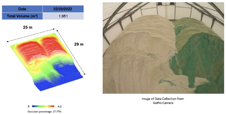
With that in mind, the research team set up LiDAR sensors and took inventory at 30 unique storage sites. Through repeated scans, researchers were able to create a point cloud that accurately estimated the volume of salt within a 1% to 3% margin of error.
“This new system allows for the state to not only keep a far more accurate inventory, but it could result in future savings due to the accurate data,” civil engineering PhD student Raja Manish said.
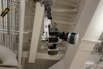
Habib said the next step in research is to install permanent LiDAR cameras in the storage facilities to ensure consistent, accurate measurements.
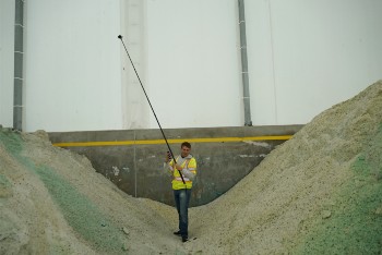
“We’ve already installed cameras in a few of the facilities that scan the area, but many of the tests were done with a tripod-mounted camera,” Habib said. “We’re excited to see this work move along so well with such strong results. This is a tremendous boon for both INDOT and Indiana’s millions of drivers.”