Geomatics Engineering
Geomatics engineers manage global geospatial resources and infrastructure. They design, develop, and operate systems for collecting, analyzing, and
utilizing geospatial information about the land, infrastructure, the oceans, natural resources, and the environment.
In Civil Engineering's Geomatics Engineering emphasis area, you will have the opportunity to study property boundary determination, digital
mapping, geodesy, geographic information systems (GIS), global positioning systems (GPS), land information management, photogrammetry, and
remote sensing. The Geomatics faculty are dedicated to effective teaching and cutting-edge research.
There are two ways to pursue a master level graduate study in Geomatics Engineering. For those interested in a specialized, focused curriculum of Geomatics Engineering, application can be made through the School of Civil
Engineering at http://eng.purdue.edu/CCE/Academics/Graduate. For those with an interdisciplinary
background, the application can be made through the Purdue Engineering Professional Education program at
http://eng.purdue.edu/ProEd.
Spotlights
July 20, 2026
Jie Shan, Reilly Professor of Civil Engineering, was presented the Schwidefsky Medal at the 25th International Society for Photogrammetry and Remote Sensing (ISPRS) Congress in Toronto, Canada.
May 14, 2026
A project team, led by Ayman Habib, has been awarded a grant of nearly $2.5 million from the National Science Foundation to generate digital twins, model how fire spreads, and conduct resilience studies for preventing and mitigating wildfires at the wildland-urban interface.
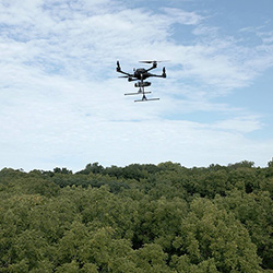
February 10, 2026
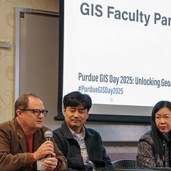
Purdue has grown a thriving forest of more than 2,000 geographic information systems (GIS) users across campus. The largest numbers come from the colleges of Agriculture, Engineering, Liberal Arts and Science. GIS and the Institute for Digital Forestry, among other Purdue academic disciplines, have grown together like trees with intertwined canopies. GIS enables users to create, manage, analyze and map data in fields such as the humanities; civil engineering; political science; and earth, atmospheric and planetary sciences.
January 6, 2026
Aser Eissa, Ph.D. student in Geomatics, has been named a recipient of the Robert E. Altenhofen Memorial Scholarship from the American Society for Photogrammetry and Remote Sensing (ASPRS).
January 6, 2026
Sang-Yeop Shin, Ph.D. student in Geomatics, has been named a recipient of the Paul R. Wolf Memorial Scholarship from the American Society for Photogrammetry and Remote Sensing (ASPRS).
December 11, 2025
Ayman Habib, Thomas A. Page Professor of Civil Engineering, has been elevated to the grade of IEEE Senior Member. IEEE Senior Membership is an honor bestowed only to those who have made significant contributions to the profession.
December 5, 2025
The IEEE Board of Directors has elevated Jie Shan, Reilly Professor of Civil Engineering, to the grade of IEEE Fellow, effective January 1, 2026. Professor Shan received this honor for his contributions to advanced LiDAR analytics and technologies.
December 13, 2024
The Purdue University Board of Trustees on Friday (Dec. 13) ratified the appointment of Jie Shan as the Reilly Professor of Civil Engineering.
November 29, 2024
Ayman Habib, Thomas A. Page Professor of Civil Engineering, has been named a Fellow of the American Society for Photogrammetry and Remote Sensing (ASPRS). This is one of the highest professional achievement awards bestowed by ASPRS.
November 29, 2024
Melba Crawford, the Nancy Uridil and Francis Bossu Professor in Civil Engineering, was recognized with the Distinguished Alumni Award for Academic Excellence from The Ohio State University during the 2024 College of Engineering Alumni Awards on October 25.
September 13, 2024
Jie Shan, Professor of Civil Engineering, has been appointed Deputy Editor-in-Chief of the IEEE journal Transactions on Geoscience and Remote Sensing (TGRS).
July 15, 2024
Using digital forestry, Purdue University researchers can identify the areas of highest risk that affect large populations and valuable infrastructure. Their efforts include developing remote sensing tech to determine the probability of wildfires.
May 30, 2024
CE graduate students Gaia Cervini and Hansae Kim placed first and second, respectively, in the Emerging Professional Group Research Competition at the 2024 Indiana GIS conference.
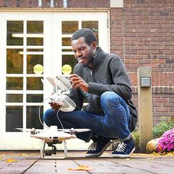
February 19, 2024
With seed money from the College of Agriculture through Plant Sciences 2.0 and the USDA's Ag2PI: Agricultural Genome to Phenome program, associate professor Jinha Jung and his team are building Data to Science (d2s) — an online platform that initially will house data from unmanned aerial vehicles for crops and forestry. On this website, users share drone data instead of videos.
January 19, 2024
An interdisciplinary research team including Melba Crawford has been selected by the Office of Research to receive SPARK funding. Launched in early 2023, SPARK (Supporting Partnering for Advanced Research teamworK) is a strategic initiative that supports and empowers Purdue researchers to achieve national prominence by establishing cutting-edge research centers.
January 18, 2024
Ayman Habib, Thomas A. Page Professor of Civil Engineering, has been honored by the American Society for Photogrammetry and Remote Sensing with the 2023 Outstanding Service Award for his contributions to the field of spatial and image sciences.
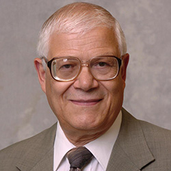
January 11, 2024
Edward M. Mikhail, Professor Emeritus of Civil Engineering, has been inducted into the Geospatial Intelligence Hall of Fame by the National Geospatial-Intelligence Agency (NGA). Established in 2001, NGA's GEOINT Hall of Fame honors and inducts members each year to recognize those who have profoundly affected the geospatial intelligence tradecraft.
December 18, 2023
CE grad student Ismail Olaniyi, along with associate professor Jinha Jung, are working on a USDA-funded project analyzing the efficacy of new therapies in the search to cure citrus greening.
September 1, 2023
A joint research team that includes Prof. Jinha Jung and PhD student Joshua Carpenter has qualified to complete in next year's $10 million XPRIZE Rainforest, a global cross-disciplinary challenge of monitoring tropical biodiversity.
August 4, 2023
The Purdue University Board of Trustees on Friday, August 4th, ratified the appointment of Melba Crawford, the Nancy Uridil and Francis Bossu Professor in Civil Engineering, as Distinguished Professor. This special recognition is bestowed on a select few professors of outstanding accomplishment who have achieved national and international prominence.