DEM Generation from High Resolution Satellite Imagery
Digital Elevation Model (DEM) generation from remotely sensed imagery is crucial for a variety of mapping applications such as ortho-photo generation, city modeling, object recognition, and creation of perspective views. Recently launched high-resolution imaging satellites (e.g., SPOT-5, IKONOS, QUICKBIRD, ORBVIEW, and EOS-1) constitute an excellent source for efficient, economic, and accurate generation of DEM data for extended areas of the Earth’s surface. In general, the procedure for DEM generation from stereoscopic views can be summarized as follows:
- Feature extraction in one of the scenes of a stereo-pair; extracted features should correspond to an interesting phenomenon in the scene and/or the object space.
- Identification of the conjugate features in the other scene; this problem is known as the matching/correspondence problem within the photogrammetric and computer vision communities.
- Intersection procedure; matched features in the stereo-scenes undergo an intersection procedure to produce the ground coordinates of corresponding object features. The intersection process involves the mathematical model relating the scene and ground coordinates.
- Densification; high density elevation data are generated within the area under consideration through an interpolation in-between the derived object space features.
The mathematical relationship between the scene and object coordinates of conjugate points can be established using either rigorous or approximate modeling of the perspective geometry of the imaging system. Rigorous modeling requires a comprehensive understating of the imaging geometry. However, the derivation of IOP (Interior Orientation Parameters) and EOP (Exterior Orientation Parameters) might not be always possible due to the lack of sufficient control, weak imaging geometry and intentional concealment by the data provider.
There has been an increasing interest to investigate approximate models (such as DLT, SDLT, RFM, Parallel Projection), which do not explicitly involve the internal and external characteristics of the imaging system. Among these models, Parallel Projection has become a popular model for its simplicity and accurate representation of imaging sensors with narrow angular field of view, which is the case for newly launched high-resolution satellite imagery.
Our group developed a complete methodology for DEM generation from stereo-satellite scenes using parallel projection model. Figure 1 depicts a stereo pair of SPOT5 scenes over Belgium. Figure 2 depicts sub-images of the normalized scenes that are generated based on the parallel projection model. Figure 3 depicts an example of successfully matched points from the normalized scenes. Figure 4 shows a 5m×5m DEM by interpolating the resulting object space points.
 (a) Left Scene
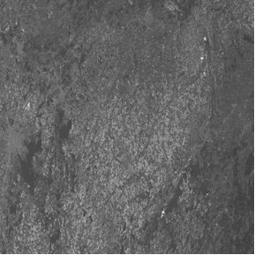 (b) Right Scene
Figure 1. Stereo pair of SPOT5 scenes over Belgium
 (a) Left Scene
 (b) Right Scene
Figure 2. Normalized SPOT5 scenes
 (a) Left Scene
 (b) Right Scene
Figure 3. Successfully matched points

Figure 4. Generated DEM from SPOT5 Scene