Geomatics Engineering
Geomatics engineers manage global geospatial resources and infrastructure. They design, develop, and operate systems for collecting, analyzing, and
utilizing geospatial information about the land, infrastructure, the oceans, natural resources, and the environment.
In Civil Engineering's Geomatics Engineering emphasis area, you will have the opportunity to study property boundary determination, digital
mapping, geodesy, geographic information systems (GIS), global positioning systems (GPS), land information management, photogrammetry, and
remote sensing. The Geomatics faculty are dedicated to effective teaching and cutting-edge research.
There are two ways to pursue a master level graduate study in Geomatics Engineering. For those interested in a specialized, focused curriculum of Geomatics Engineering, application can be made through the School of Civil
Engineering at http://eng.purdue.edu/CE/Academics/Graduate. For those with an interdisciplinary
background, the application can be made through the Purdue Engineering Professional Education program at
http://eng.purdue.edu/ProEd.
Spotlights
October 5, 2022
How lightning travels from the sky to the ground inspired the concept behind a new algorithmic approach to digitally separate individual trees from their forests in automatic forest mapping.
August 30, 2022
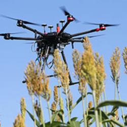
A team of Purdue civil engineers led by Ayman Habib and Darcy Bullock have developed a fully automated, portable system to estimate the volume of stockpiles of bulk supplies like salt and other materials used in industrial, highway and agricultural applications.
July 27, 2022
CE grad student Ismail Olaniyi finished second overall in the Three Minute Thesis competition hosted by the IEEE Geoscience and Remote Sensing Society (GRSS) as part of the IGARSS 2022 symposium. His thesis speech, "Developing a UAS Data Hub for the Wheat-Coordinated Agricultural Project," encapsulated his entire body of research with the aid of one presentation slide.
June 21, 2022
Jinha Jung, Assistant Professor of Civil Engineering, has been selected by the Indiana Geographic Information Council (IGIC) to receive the Education and Non-Profit 2022 Excellence in GIS Award for the Indiana Statewide LiDAR Data Portal Project.
June 10, 2022
Jinha Jung, Assistant Professor of Civil Engineering, has been elected to the Board of Directors of the Indiana Geographic Information Council (IGIC).
June 7, 2022
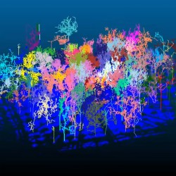
Through integration of aerial and ground-based mobile mapping sensors and systems, a team of Purdue digital forestry researchers has used advanced technology to locate, count and measure over a thousand trees in a matter of hours.
April 22, 2022
Dr. Lexie Yang from Oak Ridge National Lab will present the next geomatics seminar, "Scaling Geospatial Artificial Intelligence: Opportunities and Challenges," on Thursday, April 28, 2022, at 2:00pm via Zoom.
January 16, 2022
The research team of Jinha Jung, Purdue University and Zhou Zhang, University of Wisconsin-Madison have been awarded a grant from the U.S. National Institute of Food and Agriculture’s Agricultural Genome to Phenome Initiative (AG2PI) to advance research in sharing data using public cloud services from unoccupied aerial systems.
December 15, 2021
Jinha Jung, Assistant Professor of Civil Engineering, is collaborating in a multistate, interdisciplinary research team working to advance new, environmentally friendly and commercially viable control strategies for citrus greening. The four-year project is part of an $11 million suite of grants from the U.S. Department of Agriculture National Institute of Food and Agriculture (NIFA).
October 8, 2021
Powerful partnerships among Purdue University's colleges of agriculture, engineering and science will advance digital forestry tools to save time, money and achieve a deeper understanding of an important natural resource.
August 2, 2021
Melba Crawford, Nancy Uridil and Francis Bossu Professor in Civil Engineering, has received the IEEE Geoscience and Remote Sensing David Landgrebe Award, presented biennially for outstanding contributions in the field of remote sensing image analysis.
October 2, 2020
Melba Crawford, Nancy Uridil and Francis Bossu Professor in Civil Engineering, received the outstanding service award during the 2020 IEEE International Geoscience and Remote Sensing Symposium.
April 22, 2020
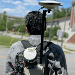
If you’ve ever seen a Google Street View car rolling down your block, you know what a mobile mapping system is. At Purdue, we’re using algorithms and artificial intelligence/deep learning to fuse this data to create a detailed digital picture of the planet.
December 12, 2019
Professor Jie Shan has been selected by the American Society for Photogrammetry and Remote Sensing (ASPRS) to receive the Fairchild Photogrammetric Award – presented by ASPRS through the ASPRS Foundation, with the support of Lockheed Martin. The purpose of the Award is to stimulate the development of the art of aerial photogrammetry in the United States.
November 20, 2019
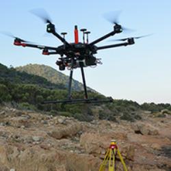
This past summer, a group from Purdue's Lyles School of Civil Engineering joined researchers on Dana Island – located off the southern coast of Turkey – to use drones and LiDAR, light detection and ranging, mapping systems to better understand the island's history.
June 28, 2019
Jie Shan, Professor of Civil Engineering, along with Purdue researchers Bo Xu and Zhixin Li, have received the best paper award at the 2019 Computer Vision and Pattern Recognition (CVPR) Workshop EarthVision for their work entitled, "Urban Semantic 3D Reconstruction from Multiview Satellite imagery." Several other co-authors from Kitware, Inc., Columbia University, and Rutgers University contributed to the paper.
February 25, 2019
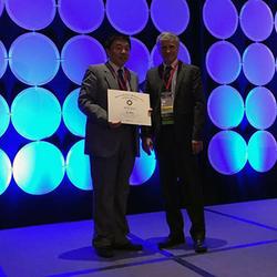
Professor Jie Shan and cohort Charles Toth, Research Professor at Ohio State University, received the 2019 LiDAR Leader Award (2nd Place) from the International LiDAR Mapping Forum. They were recognized for their edited publication, Topographic Laser Ranging and Scanning.
April 26, 2018
The United States Geospatial Intelligence Foundation (USGIF) announced Dr. Edward M. Mikhail, professor emeritus of civil engineering at Purdue University, as the 2018 recipient of the Foundation's Arthur C. Lundahl-Thomas C. Finnie Lifetime Achievement Award. Mikhail is the 14th individual to receive this prestigious award and was recognized on stage during USGIF's GEOINT 2018 Symposium general session.
April 5, 2017
Jie Shan, Professor of Civil Engineering, has been elected a Fellow of the American Society for Photogrammetry and Remote Sensing (ASPRS). Professor Shan was presented with the award at the ASPRS annual meeting held recently in Baltimore.
May 2, 2016
Ms. Chisaphat Supunyachotsakul, a doctoral candidate in the geomatics area advised by Prof. James Bethel, is the recipient of the 2016 Robert E. Altenhofen Memorial Scholarship.