CE Impact Magazine - Fall 2015


Download issue in pdf format

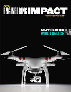
Mapping in the modern age

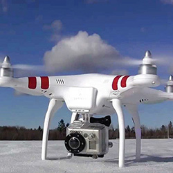
Unmanned aerial vehicles (UAV) are emerging in many technological fronts and their use is growing quickly. Professor Ayman Habib and other researchers within the geomatics area of the Lyles School of Civil Engineering are working to address the challenges surrounding the manipulation of acquired data by digital imaging systems onboard these low-cost UAVs.

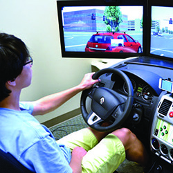
Getting data on drivers | The NEXTRANS driving simulator laboratory

Advances in roadside signage technology, smartphones and in-vehicle navigation devices have led to increased, and increasingly personalized, communications to travelers en route. In fact, recent reports suggest that the number of automobiles with in-vehicle navigation systems will quadruple in North America by 2019, growing to nearly 13 million new systems annually. Regrettably, this rise in information available to travelers can lead to increased distracted driving.

The future of architectural engineering is here today

Researchers working at Purdue in the field of engineered environments had a vision for a facility with a fully instrumented living laboratory: offices with reconfigurable facades, multiple comfort delivery modes and primary equipment enabling controlled testing. They also imagined a perception-based engineering (PBE) facility to study the combined effects of lighting, acoustics, air quality, vibration, temperature, humidity and air flow on occupant perceptions and performance. They dreamed of creating a center to house these unique facilities along with more traditional laboratory-scale test facilities that are useful for controlled testing of building envelopes, lighting and facades, air distribution, cooling and heating equipment, heat exchangers, compressors and more.
Viewing 1 to 4 of 4