3-D imagery helps detect danger zones
Narrow lanes in work zones make for nervous and less attentive drivers, Purdue researchers say — and the data they’re collecting is backing them up.
It’s a common feeling drivers get on the road when the lanes shrink due to construction: nervousness, anxiety — perhaps even a bit of panic. Even if drivers feel only a little nervous, researcher Ayman Habib says these effects can cause significant shifts in a driver’s attentiveness. Habib is a professor of civil engineering in the Lyles School.
“Whenever there are work zones and the lanes narrow, we’ve seen more stress in our drivers,” Habib says. “The more stress they experience, the higher the probability of a crash.”
Habib, along with staff and graduate and undergraduate student researchers, has been working with the Indiana Department of Transportation to increase traffic safety in work zones. Currently in Phase 1 of the study, Habib says they have observed a strong tie between narrow lanes and poor driving.
“From what we’ve observed so far, if a lane is narrowed to less than 10 feet wide — regardless of the type of vehicle driven — poorer driving increases,” he says. “It is especially prevalent if the road has any turns. Turns make drivers more likely to drift into another lane because they aren’t prepared for the shift in direction, or they overcorrect the other way.”
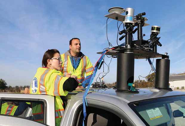
To collect this data, student researchers drive vehicles equipped with LiDAR (light detection and ranging) devices that generate three-dimensional images. LiDAR is a surveying system that measures distance by illuminating a target with laser light.
With the LiDAR devices, researchers have 360 degrees of visual data to work with, rather than flat images. These 3-D images, Habib says, provide a much deeper level of understanding by revealing exactly where traffic is being most affected and why.
Jim Sturdevant, director of INDOT’s Traffic Management Division, says the use of LiDAR technology has led to greater insight than previous studies.
“Historically, our data-collection practice has been to mount a GoPro to the car,” Sturdevant says. “You don’t see side-to-side well, and you cannot measure distances across lanes under live traffic — so you just eyeball it. LiDAR instrumentation creates something resembling a 3-D wire frame model of the terrain. It allows us to measure to almost an inch.”
Sturdevant adds that although research began only recently, in August 2016, he is optimistic about the work and hopes it results in increased traffic safety in work zones.
Phase 1 of the study continues through November 2017. Habib’s team received $100,000 from the Federal Highway Administration and $50,000 from INDOT for the first phase.
During Phase 2, Habib says his team will expand its research to include other driving factors such as signage, shoulder width, shoulder barriers and lane marking conditions to better pinpoint other factors, in addition to road width, that contribute to driver anxiety and traffic congestion in work zones.