Satellite data: Iraq's Mosul Dam in danger

Through studying satellite images over a 12-year period, Purdue Civil Engineering researchers have made an alarming discovery: Iraq’s Mosul Dam is destabilizing and in danger of failing.
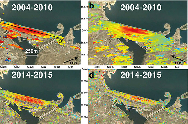
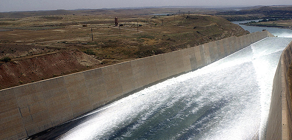
The work is led by Daniele Perissin, assistant professor of civil engineering in the Lyles School. He and his research team — in partnership with the NASA Jet Propulsion Laboratory — recently presented a detailed survey of the ongoing destabilization process of the Mosul Dam. Since 2004, the dam has undergone a displacement of more than 100 millimeters (about four inches). The 3-kilometer-long dam, located on the Tigris River, was built in 1986 and is the biggest hydraulic structure in Iraq.
Perissin’s team developed a multisensor cumulative deformation map for the dam, generated from space-based interferometric synthetic aperture radar measurements from the Italian constellation COSMO-SkyMed and the European sensor Sentinel-1A from 2014 through 2016. The data spanning 2004-10 was acquired with the European Envisat satellite.
Perissin’s team concluded that the dam foundation is poor due to its site geology, which is formed by alternating strata of highly soluble materials including gypsum, anhydrite, marl and limestone. As a result, the dam is at risk of failure and catastrophic flooding that could affect about 1.5 million people living near the Tigris.
Perissin says it is his hope that the information he has compiled will be used to assist in future dam repair planning.
In 2016, the Government of Iraq Ministry of Water Resources issued a $300 million contract to the Trevi Group to make repairs. The U.S. Army Corps of Engineers is serving as the engineer of record on behalf of the Government of Iraq, responsible for overseeing the execution of the work. Maintenance and cement grouting operations have since ceased. The spillways also remain blocked, raising concerns about possible dam failure, Perissin adds.
“We will continue to monitor and track the dam,” Perissin says. “Our goals are to inform and be of assistance in the future.”