Aging Dams, Rising Dangers
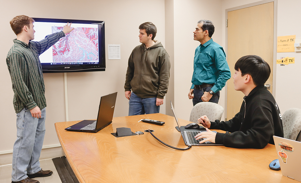
Aging dams in the U.S. pose a significant risk, with more than 16,000 labeled a high hazard. Researchers with the NSF-funded Institute for Geospatial Understanding through an Integrative Discovery Environment (I-GUIDE) initiative use advanced modeling to help communities prepare for rare but catastrophic dam failures. Professor Venkatesh Merwade, graduate student researchers Sang Woo Bae and Aiden Griggs and undergraduate student researcher David Wilson develop and test two-dimensional inundation models to turn complex data into actionable emergency plans to save lives and reduce damage.
“The National Inventory of Dams reports over 92,000 dams in the United States, averaging 64 years old,” Bae said. “Of these, 16,841 are high hazard, where failure or mis-operation could cause loss of life and significant damage.”
The team concentrates on dams most likely to cause loss of life and damage — those classified as high hazard, over 50 feet tall or in unique regions. This targeted approach anchors the research, ensuring the team’s modeling has real, broad impact.
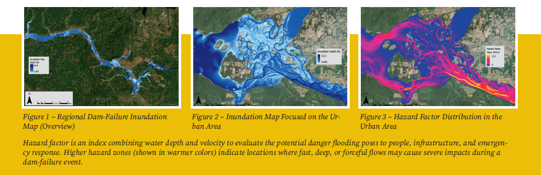
Using a comprehensive suite of tools to simulate dam failures, the team models rainfall-runoff and inflow hydrographs with HEC-HMS, simulates breach processes and downstream flooding using HEC-RAS and creates detailed flood maps in ArcGIS. They ensure accuracy by collecting essential data — terrain features, reservoir levels, surface characteristics, precipitation and land-use information — using dynamic datasets such as Digital Elevation Models (DEMs). Their latest work focuses on a scalable modeling approach for robust analysis of dam breach scenarios and identifying regions most at risk.
Merwade provides overarching direction for the research, shapes methodology and ensures the project aligns with I-GUIDE’s objectives. He leads collaborations with Purdue and other partners and oversees access to the computing resources vital for large-scale simulations.
“It is exciting to see our graduate and undergraduate students collaborate and work together to use the modeling skills they have learned in classes, and apply them very meticulously to address the critical problem of flooding with broader societal impacts,” Merwade said.
Dam-failure research brings unique challenges: real-world breaches are unpredictable, and large-scale simulations require significant computing power. Researchers must make informed assumptions about breach size, rainfall patterns and other variables — choices that can dramatically affect the predicted impact of downstream flooding. To address both uncertainty and computational demands, the team uses Purdue’s Anvil supercomputer to rapidly run countless scenarios. This enables systematic testing of assumptions, revealing both worst-case possibilities and a spectrum of realistic outcomes. Ultimately, this approach makes dam safety assessments smarter, more comprehensive and more valuable for protecting at-risk communities.
Because dam-failure inundation maps are inherently uncertain, the team uses multiple strategies to ensure reliable results. By validating their models against government maps, following United States Army Corps of Engineers and Federal Emergency Management Agency guidelines, and integrating critical data like elevation, reservoir levels, land use and precipitation, they deliver robust, credible simulations. This rigorous approach equips communities with the tools they need to prepare for and reduce the devastating impacts of dam failures.