Driven By Data
Modernizing Indiana's traffic models with insights from vehicular data
As travel and vacation plans through the state evolve, so must their analysis.
Lyles School of Civil and Construction Engineering Professor and director of Purdue’s Sustainable Transportation Systems Research Group (STSRG) Nadia Gkritza is leading a research team that aims to refine Indiana’s trip generation procedures by incorporating local data for emerging and rapidly changing land uses such as warehouses, gas stations and fast-food restaurants.
“This research seeks to enhance the accuracy of travel demand models and traffic impact studies by integrating updated variables and context-specific insights tailored to Indiana,” Gkritza said. “This includes paying attention to the statistical and analytical components, managing data collection and processing, and developing models that better reflect current travel behavior trends.”
Since research began in the fall of 2024, the team’s data has already shown that previous surveys are greatly underestimating the amount of travelers Indiana sees daily.
“Traffic numbers definitely appear to have been underrepresented in the past,” Gkritza said. “We’re hoping that once we complete our research, the state will be able to better identify sections of roadway that need to be expanded to alleviate existing traffic congestion and allow them to prepare for areas showing signs of traffic growth.”
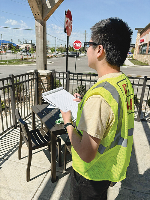
Civil engineering undergradate student Jiayu Zhu monitors and records street traffic data.
Graduate student researcher Rishika Tumula oversees both the technical and operational aspects of the work. She also leads the student research team, which includes 11 undergraduates from Purdue’s CCE and mechanical engineering schools.
Together, the student team is advancing research that not only improves planning tools for the state but also fosters meaningful handson learning experiences for future engineers. So far, they have made 15 site visits across five locations throughout Indiana, and plan to study at least 20 other locations.
“We’re putting together user data to better understand the evolving travel and resting habits of drivers along the state’s busiest highways and rest stops,” Tumula said. “We collect data at multiple points throughout the day and document everything we can from average traffic flow to detailed site characteristics such as business type, building and parking area, and service capacity.”
Undergraduate researcher Carmen Caserio added that in addition to this data being beneficial to current traffic management efforts, it will also paint a better picture for local governments and the transportation agencies to plan future infrastructure improvements.
“By studying not just how many vehicles, but which types of vehicles use the roads, we can better predict which roads will more frequently need maintenance as well as which areas are best suited to serve travelers,” Caserio said.
Supporting the STSRG in their research are the Indiana Department of Transportation and Joint Transportation Research Program. Gkritza said she expects to release a report of her team’s findings in 2026.