 Indiana Watersheds Webinar Series Webinars to Strengthen Watershed Management in Indiana
 Using FREE GIS Tools for Watershed Management
|
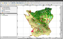
Aired: May 14, 2014 from noon to 1pm Eastern Want to make a map now and then but can not afford a dedicated desktop GIS license? My webinar will introduce the concept of Open Source GIS software, and in particular will discuss QGIS, a full-featured and easy-to-use GIS program that runs on Macintosh, Windows, Linux, and Android. It can use many data types, has an easy shapefile editor, contains standard Geoprocessing tools like clip, buffer, union, intersect and can do raster processing such as slope, hillshade, and delineation. QGIS is free, and actively being supported by a community of users. |
Presentation slides (in pdf) View the archived webinar
| |
|
|
Meet the Presenter: Larry Theller, GIS Systems Specialist, Purdue University |
Tips for saving paper when printing pdf presentations:
To print multiple pages on each sheet of paper, download the file, click on "File" then "Print". Under Page Handling, select Page Scaling, then print multiple pages per sheet (i.e., 6 or 9 pages per sheet).