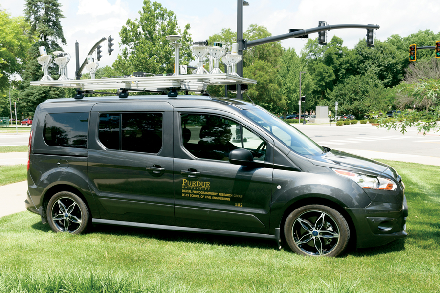
Road construction. It’s the bane of every driver but, if the work is executed efficiently, construction crews can minimize traffic headaches and frayed nerves. Ayman Habib, the Thomas A. Page Professor of Civil Engineering, is a critical ally in this delicate dance. Habib’s research on mobile mapping systems is intended to provide high-definition, high-fidelity 3D maps and data of the road network, which can be mined for insights. Case in point: the mobile mapping system can accurately provide lane widths while driving at normal speed and guide construction crews to maintain appropriate lane width so as to disrupt traffic only minimally.
Habib points out that mobile mapping systems are adaptable according to need. The sensor payload can be mounted on any mobile platform, whether that be a drone for aerial surveillance or on a moving car. A typical mapping system is bristling with sensors: regular RGB cameras like the kind you can buy from Best Buy; sophisticated imaging systems that provide more spectral information; a GPS/INS (Inertial Navigation System) that accurately evaluates the position and orientation of the platform; and LiDAR (Light Detection and Ranging) instruments that scan surfaces by using laser beams. Together, they provide extremely detailed mapping information that can be used as a powerful analytical tool.
Revving up research
On-the-road applications of Habib’s remote mapping systems include crash scene documentation and infrastructure monitoring of roads and bridges so departments of transportation can make well-informed decisions about prioritizing repairs. “Sometimes roads can be shut down for hours after major traffic accidents and you can have back-of-queue accidents as a result,” Habib says. “We are using remote mapping systems on drones to increase the accuracy and to decrease time for documentation of the crash scene.”
Conducting mobile mapping of road infrastructure also minimizes the need for frequent deployments of maintenance crews, Habib says. “Wheel-based and drone systems can conduct inspections much more frequently and they are less error-prone,” he adds, which means significant cost savings over the long term.

