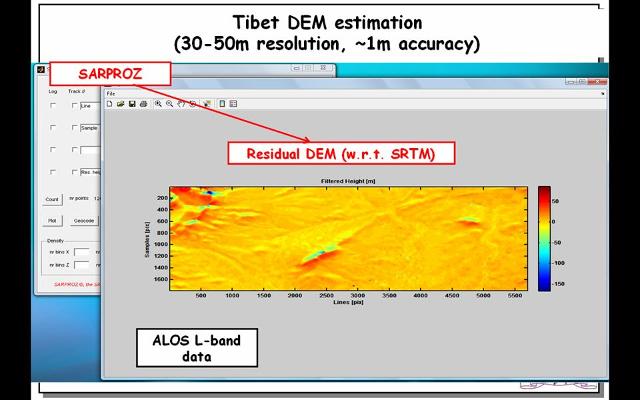
A digital elevation model estimated by Sarproz with few L band images in Tibet. The image is the residual height w.r.t SRTM data. You can see the railway track on the left bottom. This image has been estimated by the Quasi-PS technique. In this area there are no Permanent Scatterers, but there is coherence. Sarproz analyses all possible interferograms and finds the coherent ones. Through those interferograms, the height can be estimated practically over all pixels.