
Cooperators: B. A. Engel, R. H. Mohtar, N. J. Carroll, ABE
 |
|
Ravi Narayanan,
Soil and Water, Watershed Modeling |
Alyson Faulkenburg,
Soil and Water, Watershed Management |
| | To develop a watershed assessment tool using GIS information to assist farmers, agencies, and local communities in making decisions about land use and management practices based on their effects on water quality, particularly within source water areas for public water supplies. |
| | To refine a GIS-based hydrologic model for the assessment of critical areas where there is a high probability of nutrient and pesticide loss within watersheds. |
| | To develop a method based on simulated threshold rates of overland flow for the identification of intermittent streams where pesticide use should be limited. |
Recent Publications:
Frankenberger, J .R. and M. F. Walter. 1997. Evaluation
of diversions using a variable source area model. ASAE Paper No. 97-2061.
St. Joseph, MI: ASAE.
Frankenberger, J. R., E. S. Brooks, M. T. Walter, M. F. Walter and T. S. Steenhuis. 1998. A GIS-based variable source area hydrology model. Hydrologic Processes. (In press.)
Statement of Problem: The 1996 amendments to the Safe Drinking Water Act identify source water protection as an important component of protecting water supplies. Surface water supplies approximately 50% of the water for public drinking water sources in Indiana, and surface water supplies are particularly vulnerable to contamination from nonpoint sources. Pesticides, pathogens and nutrients have all been found at concentrations of concern in source water used for public drinking water supplies. A watershed protection program based in and run by the local community is widely believed to be the most effective strategy for ensuring safety of the water supply. Communities are searching for watershed management strategies, including identifying the most critical areas within the watershed where watershed protection efforts can be targeted
Intermittent streams and the areas surrounding them are examples of critical areas within watersheds. The Environmental Protection Agency (EPA) has restricted the application of atrazine, the most widely-used herbicide in Indiana, within 66 feet of the point where surface runoff enters an intermittent stream in order to protect water quality. The difference between an intermittent stream and a concentrated flow path for runoff water is not clearly defined. GIS-based models of soil moisture and surface runoff distribution in complex landscapes can be used to clarify the definition using a threshold flow concept.
Current Activities: The focus of this research is to equip community decision makers to develop strategies to protect their watershed from possible contamination. We have delineated watersheds for 60 communities, ranging in size from 0.1 km^2 to more than 400,000 km^2, and digitized them into GIS. A simple watershed assessment tool that can be scaled to this wide range of size and complexity is being developed, and will be evaluated with respect to both a hydrologic model and water quality monitoring taking place within a sample of the watersheds.
Weighted watershed curve number (runoff index), herbicide application per unit watershed area (chemical use index), watershed size, amount of watershed land in conventional tillage, and average watershed slope were tested for their ability to predict mean herbicide concentration using simple and multiple regression analysis.
The Soil Moisture Routing Model was developed to simulate streamflow based on the variable source area process of surface runoff. It uses a routing algorithm for subsurface flow, and can therefore be used to simulate flow rates for watersheds characterized by this process. Topography, soil, and precipitation data are modeled within a GIS, and used to predict both streamflow and soil moisture. Indiana climatic data will be used to simulate flow rates within watersheds, to determine how model outputs can be used for intermittent stream definition and interpretation of atrazine label restrictions.
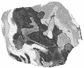 |
| Surface runoff-generating areas predicted for a small watershed using the soil Moisture Routing Model. |