Relief map of Turkey.

Relief map of the disaster area.

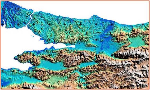
Pseudo-colored topographic map of the region using
satellite data.
(Prepared by TUBITAK-METU BILTEN RSGIS)
The active faults on the North Anatolian Fault System
in northwestern Turkey.
(This map shows the active faults mapped by the Mining Exploration
and Research General Directorate (MTA) of Turkey.)

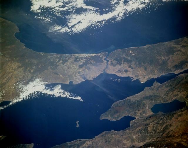
A closer look at the region of the August 17, 1999 event.

Road Map of the Disaster Region