| |
How L-THIA Works
L-THIA is based on computations of daily runoff obtained from long term climate records, soil data, CN value and land use of the area. By applying the method to actual and planned (zoned) urban developments the long term effects of past, present and future land use can be determined.
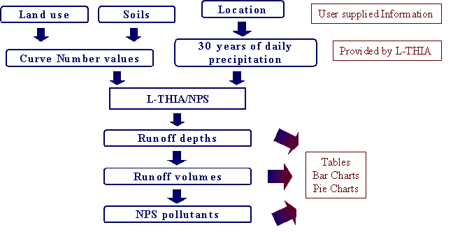
The basic information required for the model is:
- Location in terms of State and County which is to be selected from the
list available on the 'input' page of L-THIA. This is used to select local
climate data stored in the database. It is used in the analysis.
- Area under past, present and future land uses. This can be obtained from
paper or digital maps. Satellite images and air photos can be used to determine
the land uses.
- Hydologic Soil groups for land use areas. These can be obtained from the standard soils data layer in GIS or from your local Soil and Water Conservation District (SWCD)