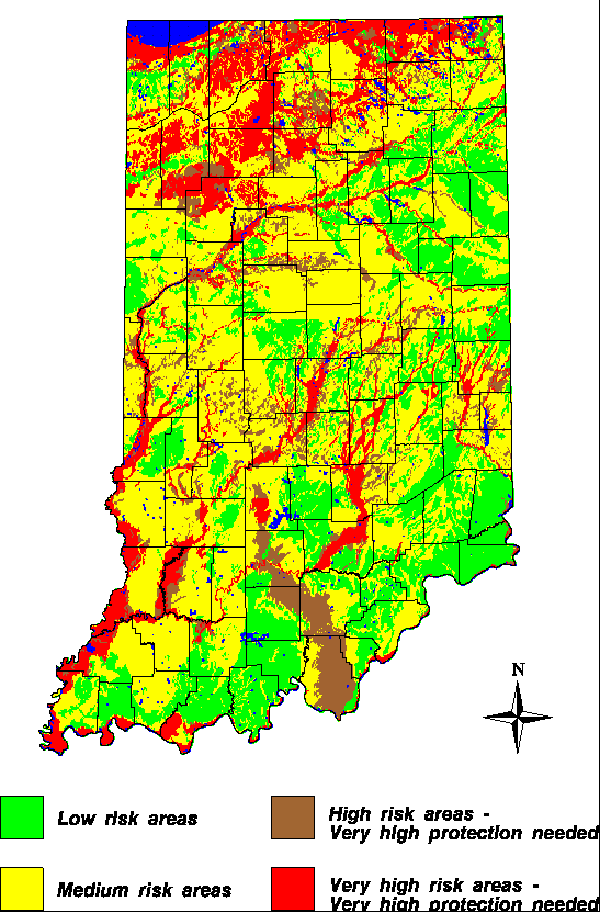
This map was developed by Brian Cooper using the DRASTIC model, 1996. Explanation for the DRASTIC model, as well as layers used to create this map can be found here.