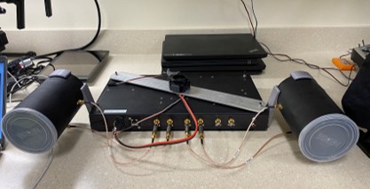
Airborne soil moisture retrieval systems allow the collection of data from a large area. The data product can be used for farming/ hazard management etc. Currently, there are two systems under development at our lab.
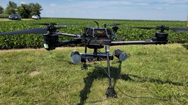
The DroneSAR system is a synthetic aperture radar system based on a drone. The system is originally developed at Cape Town University, South Africa known as MiloSAR.
Currently, the system is under development for data retrieval for soil moisture, plant monitoring etc.
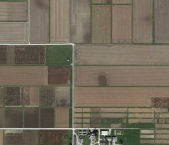
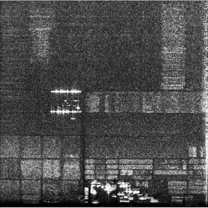
SAR image comparison with a satellite RGB