Geomatics Engineering
Geomatics engineers manage global geospatial resources and infrastructure. They design, develop, and operate systems for collecting, analyzing, and
utilizing geospatial information about the land, infrastructure, the oceans, natural resources, and the environment.
In Civil Engineering's Geomatics Engineering emphasis area, you will have the opportunity to study property boundary determination, digital
mapping, geodesy, geographic information systems (GIS), global positioning systems (GPS), land information management, photogrammetry, and
remote sensing. The Geomatics faculty are dedicated to effective teaching and cutting-edge research.
There are two ways to pursue a master level graduate study in Geomatics Engineering. For those interested in a specialized, focused curriculum of Geomatics Engineering, application can be made through the School of Civil
Engineering at http://eng.purdue.edu/CE/Academics/Graduate. For those with an interdisciplinary
background, the application can be made through the Purdue Engineering Professional Education program at
http://eng.purdue.edu/ProEd.
Spotlights
February 19, 2024
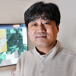
With seed money from the College of Agriculture through Plant Sciences 2.0 and the USDA's Ag2PI: Agricultural Genome to Phenome program, associate professor Jinha Jung and his team are building Data to Science (d2s) — an online platform that initially will house data from unmanned aerial vehicles for crops and forestry. On this website, users share drone data instead of videos.
January 19, 2024
An interdisciplinary research team including Melba Crawford has been selected by the Office of Research to receive SPARK funding. Launched in early 2023, SPARK (Supporting Partnering for Advanced Research teamworK) is a strategic initiative that supports and empowers Purdue researchers to achieve national prominence by establishing cutting-edge research centers.
January 18, 2024
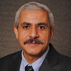
Ayman Habib, Thomas A. Page Professor of Civil Engineering, has been honored by the American Society for Photogrammetry and Remote Sensing with the 2023 Outstanding Service Award for his contributions to the field of spatial and image sciences.
January 11, 2024
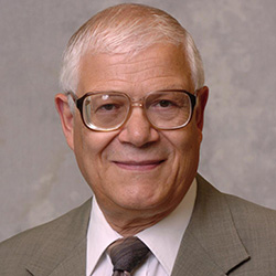
Edward M. Mikhail, Professor Emeritus of Civil Engineering, has been inducted into the Geospatial Intelligence Hall of Fame by the National Geospatial-Intelligence Agency (NGA). Established in 2001, NGA's GEOINT Hall of Fame honors and inducts members each year to recognize those who have profoundly affected the geospatial intelligence tradecraft.
December 18, 2023
CE grad student Ismail Olaniyi, along with associate professor Jinha Jung, are working on a USDA-funded project analyzing the efficacy of new therapies in the search to cure citrus greening.
September 1, 2023
A joint research team that includes Prof. Jinha Jung and PhD student Joshua Carpenter has qualified to complete in next year's $10 million XPRIZE Rainforest, a global cross-disciplinary challenge of monitoring tropical biodiversity.
August 4, 2023
The Purdue University Board of Trustees on Friday, August 4th, ratified the appointment of Melba Crawford, the Nancy Uridil and Francis Bossu Professor in Civil Engineering, as Distinguished Professor. This special recognition is bestowed on a select few professors of outstanding accomplishment who have achieved national and international prominence.
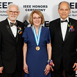
July 3, 2023
For her "contributions to remote sensing technology and leadership in its application for the benefit of humanity," Purdue University Civil Engineering Professor Melba Crawford is the recipient of this year's IEEE Mildred Dresselhaus Medal.
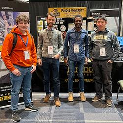
February 20, 2023
Assistant Professor Jinha Jung, along with a group of geomatics graduate students, represented Purdue Geomatics at the 71st annual conference of the Indiana Society of Professional Land Surveyors, held January 18-20 in Fort Wayne, Indiana.
January 27, 2023
Congratulations to CE grad students Gaia Cervini and Lena Azimi for placing 2nd and 3rd, respectively, in the Indiana Geographic Information Council's first-ever Emerging Professional Research Competition.
December 7, 2022
Melba Crawford, the Nancy Uridil and Francis Bossu Professor in Civil Engineering, is the recipient of the 2023 Institute of Electrical and Electronics Engineers (IEEE) Mildred Dresselhaus Medal.
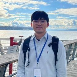
November 15, 2022
PhD Student Hunsoo Song won 1st place in the GIS Cup of the 30th ACM SIGSPATIAL. This year's GIS Cup awards the person who developed the most accurate algorithm for 3D building mapping using airborne LiDAR data.
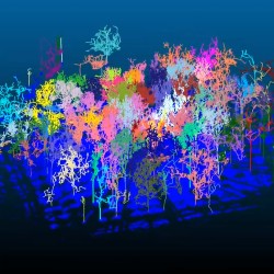
October 5, 2022
How lightning travels from the sky to the ground inspired the concept behind a new algorithmic approach to digitally separate individual trees from their forests in automatic forest mapping.
August 30, 2022
A team of Purdue civil engineers led by Ayman Habib and Darcy Bullock have developed a fully automated, portable system to estimate the volume of stockpiles of bulk supplies like salt and other materials used in industrial, highway and agricultural applications.
July 27, 2022
CE grad student Ismail Olaniyi finished second overall in the Three Minute Thesis competition hosted by the IEEE Geoscience and Remote Sensing Society (GRSS) as part of the IGARSS 2022 symposium. His thesis speech, "Developing a UAS Data Hub for the Wheat-Coordinated Agricultural Project," encapsulated his entire body of research with the aid of one presentation slide.
June 21, 2022
Jinha Jung, Assistant Professor of Civil Engineering, has been selected by the Indiana Geographic Information Council (IGIC) to receive the Education and Non-Profit 2022 Excellence in GIS Award for the Indiana Statewide LiDAR Data Portal Project.
June 10, 2022
Jinha Jung, Assistant Professor of Civil Engineering, has been elected to the Board of Directors of the Indiana Geographic Information Council (IGIC).
June 7, 2022
Through integration of aerial and ground-based mobile mapping sensors and systems, a team of Purdue digital forestry researchers has used advanced technology to locate, count and measure over a thousand trees in a matter of hours.
April 22, 2022
Dr. Lexie Yang from Oak Ridge National Lab will present the next geomatics seminar, "Scaling Geospatial Artificial Intelligence: Opportunities and Challenges," on Thursday, April 28, 2022, at 2:00pm via Zoom.
January 16, 2022
The research team of Jinha Jung, Purdue University and Zhou Zhang, University of Wisconsin-Madison have been awarded a grant from the U.S. National Institute of Food and Agriculture’s Agricultural Genome to Phenome Initiative (AG2PI) to advance research in sharing data using public cloud services from unoccupied aerial systems.